In the beginning there was a veridical London Underground map in which geometry and topology were preserved, i.e. the maps is very similar to the geographic environment (from 1908).
 |
| Source: Wikipedia (http://en.wikipedia.org/wiki/File:Tube_map_1908-2.jpg) |
From 1931, Harry Beck started to rework the tube map realizing that any the topology of the network (e.g. connectivity, neighborhood relations) was important not so much its geometry (e.g. distances, angels). So he introduced the schematisation of the intersections to be quadlinear (i.e. all angles are abstracted to 90° and 45°) and the conncection between intersection to be straight (with some roundness at corners):
 |
| Source: Wikipedia (http://en.wikipedia.org/wiki/File:TubeMapZ1_TFL.png) |
There were several suggestions for improving the Beck map (and its successors) as with the schematic map it was hard to estimate distances or direction between stations. Recently, the idea of maps that are less schematic but that make it easier to match the geographic reality to foster comprehension by the users has gained some attention. Relaxing the constraints of straight lines only and multiple of 45° angles only can produce more veridical (and less schematic) maps like this one by James D. Forrester:
| Source: Wikipedia (http://en.wikipedia.org/wiki/File:London_Underground_Zone_1.svg) |
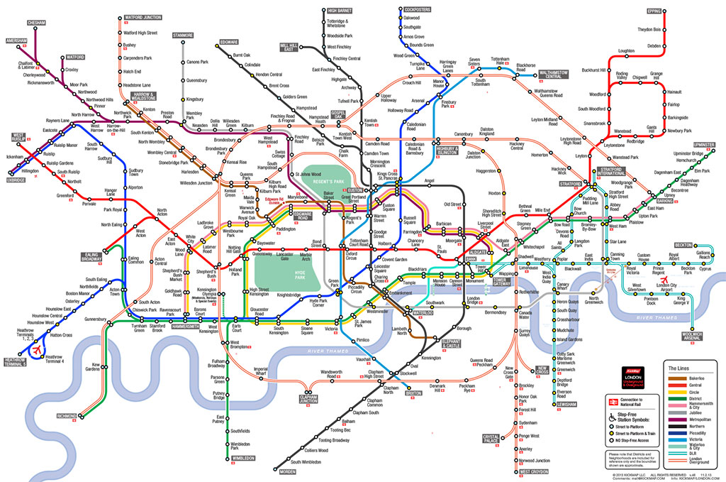
The KickMap of the London Underground by Eddie Jabbour is another, more recent example. The development was motivated by the fact that the modern underground map has properties that make it hard to understand, for example, how above ground landmarks relate to undergound lines:
"Contributing to the confusion is the trend of modern Tube Map designs to be even more abstracted than Beck's original, resulting in a severe disconnection from the above-ground geography of London. This unfortunate drift is apparent by looking at London's geographic anchor, the River Thames, and its relation to stations as drawn by Beck, and comparing it to the present Tube map's Thames rendering and its relation to stations. Indeed, a few years back the tendency toward abstraction culminated in the Thames being removed entirely from the official Tube Map." (KickMap of the London Underground)See this O'Reilly Radar post to understand the inspirations, the constraints, the trade offs, the multiple iterations that went into the final design.
 |
| Source: KickMap London (http://www.kickmap.com/London/images/KMAP_LONDON_SMALL_lg.jpg) |
Another map that set out to enhance the current underground map is the London Tubemap by Mark Noad. As well as the KickMap, the TubeMap is not only topologically correct but preserves the geometry as much as possible to ensure that "the stations are geographically-accurate in relation to each other" (http://www.london-tubemap.com/about_the_map.php). On the downside there are more information in the map that the user needs to proces cognitively, for example, different slopes of lines and even freeform shapes of lines.
In my PhD I discuss what kind of schematisations could facilitate the comprehension of tactile orientation maps that are produced with a tactile printer. I tested different levels of abstraction that resulted in schematized maps (see below) and their effect on map understanding.
The thesis is to be published soon. Articles and presentation of the work can be found here.


