In Hamburg there is a quite vibrant scene of blind and visually-impaired people, most prominently gathered in the BSVH, the society of blind and visually-impaired people Hamburg.The activities of the BSVH are targeted at community building through joint activities, public awareness through the distribution of information, and policy advocacy through giving advice and comments to policy makers. The society gathers relevant news, publishes the newsletter "Augenblick Mail" and its own press releases and twitter feed, has an event calender and provides information about sight-related illnesses and where to get help in Hamburg. Once a month there is the BSVH-Treff, a two-hour talk session aired by the Hamburg local radio station, that is available as podcast as well.
Heiko Kunert, the current public relation officer and designated manager general from 2012 on, is the most visible beacon of the active community members. He runs the blog Blind-PR where he comments on current developments of assistive technology, public policies and a diversity of issues adjacent to the needs and rights of people with special needs. Heiko supported different media in reporting about aspects of living with visual impairements, for example, in "DIGIsellschaft" for ZDF Elektrischer Reporter or in "Mein Leben als Blinder" for Pro7 Galileo.

Blog about non-visual navigation, especially with tactile maps
Thursday, September 29, 2011

Thursday, September 8, 2011
Ken Forbus talked about "Sketching our way to human-level AI"
On Tuesday, Ken Forbus from the Northwestern University gave a talk "Sketching our way to human-level AI" as part of his 3-day visit to the SFB/TR 8 Spatial Cognition research group at the University of Bremen:

For me, the talk was highly interesting as it opened up a perspective how to analyse sketches of maps in a conceptual way. Other pictures are available here
In a personal conversation one day later, Ken took the time and discussed with me how I could use CogSketch in my research. This approach allows to compare sketches and helps to segment them into the basic conceptually entities. The algorithms and knowledge base behind CogSketch allow to compute a similarity value on the ground of spatial properties, for example, the directional relations of entities, their neighbourhood, the containment etc. CogSketch is really amazing and I will definitely give a try!
Thank you Ken for your time and your advice and please continue with your collaborators to provide such great tools like CogSketch!
"This talk will summarize two large-scale efforts at Northwestern: (1) CogSketch, an open-domain sketch understanding system. Our goal with CogSketch is to make it a useful research instrument for cognitive scientists (including AI researchers) and as a platform for sketch-based educational software. (2) Companion cognitive systems, a cognitive architecture which makes analogical processing central. Our goal with Companions is to create the first software social organisms, a step towards human-level artificial intelligence. I'll focus on aspects of these efforts that might be particularly interesting from the perspective of potential collaborations: knowledge capture games to explore the semantics of spatial language, modeling 3D reasoning of engineers, learning by reading, and apprenticeship learning in a strategy game."

For me, the talk was highly interesting as it opened up a perspective how to analyse sketches of maps in a conceptual way. Other pictures are available here
In a personal conversation one day later, Ken took the time and discussed with me how I could use CogSketch in my research. This approach allows to compare sketches and helps to segment them into the basic conceptually entities. The algorithms and knowledge base behind CogSketch allow to compute a similarity value on the ground of spatial properties, for example, the directional relations of entities, their neighbourhood, the containment etc. CogSketch is really amazing and I will definitely give a try!
Thank you Ken for your time and your advice and please continue with your collaborators to provide such great tools like CogSketch!
Conferences on Tactile Maps or Cognitive Issues of Navigation
Recently, the 1st European State of the Map Conference of the OpenStreetMap project took place in Vienna, Austria. Participants from various countries were present and listened to a bunch of interesting talks. In the context of my research, the talk by Annette Thurow on OSM for blind users was particularly insightful. How to make customized maps from OSM data with Maperitive was demonstrated as well. All recordings of the presentations and conference proceedings (PDF) are available.
Upcoming conferences and possibly relevant presentations:
Upcoming conferences and possibly relevant presentations:
- Braille21 in Leipzig:
- T2: Banning a Chimera with the Hyperbraille Display
Prof. Gerhard Weber - 10th COSIT in Belfast (US):
- Poster: Towards a theory of spatial assistance from a phenomenological perspective: Technical and social factors for blind navigation
Kirsten Jacobson, Nicholas A. Giudice, and Reinhard Moratz - Poster: A Conceptual framework for comparing navigation across different domains: Lessons from blind navigation
Julio C. Mateo - Paper: Towards Cognitively Plausible Spatial Representations for Sketch Map Alignment
Malumbo Chipofya, Jia Wang, Angela Schwering - Paper: The Effect of Activity on Relevance and Granularity for Navigation
Stephen Hirtle, Sabine Timpf and Thora Tenbrink
Saturday, August 20, 2011
Projects about constructing physical tactile maps
Projects
Different techniques to produce physical tactile representation of space
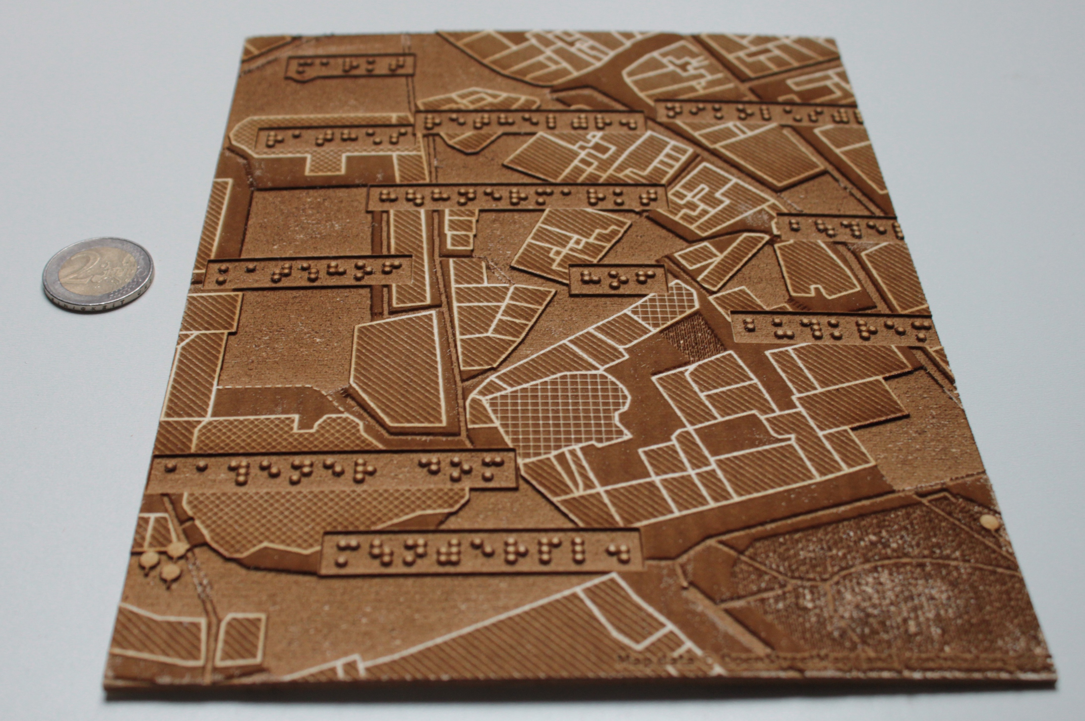
Tactile maps with a laser cutter (photo)
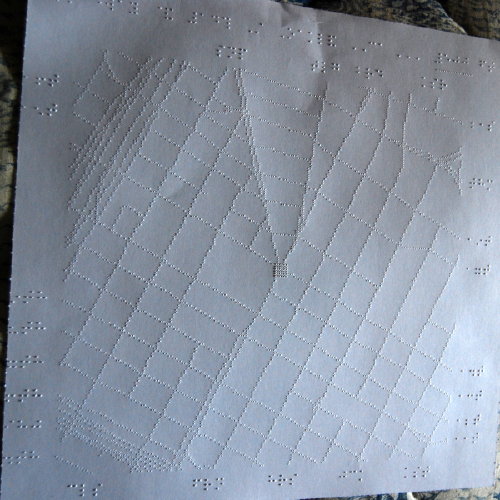
Tactile maps with a braille printer (photo)
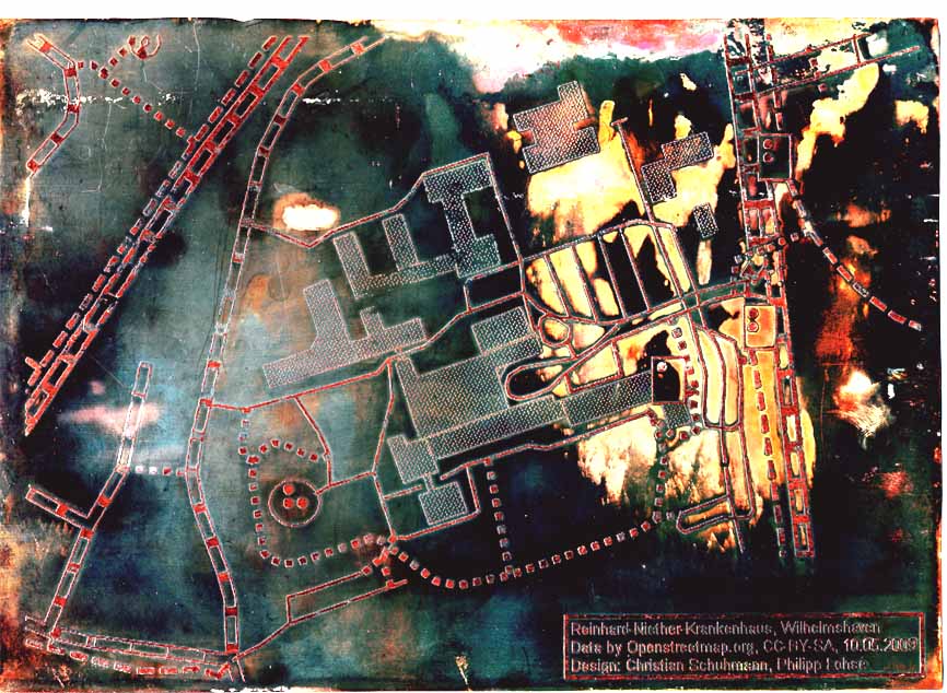
Tactile maps with HaptoRender currently made from copper and probably from plastics in the future
Tactile maps with a 3d printer (PDF paper)
Examples of hand-crafted physical tactile representations
Ancient tactile maps of greenland
Different types of terrain models, relief types and techniques (ETH Zürich)
Tactile maps hand-crafted made from metal in Bremen (photo), in Bergen (photo)
3d models cast from copper: in Edinburgh, in Leipzig (photo)
- Definition of what a tactile map is (with examples) [German]
- Presentation "Status der Blindennavigationsprojekte" (PDF) (as MP4) by Annette Thurow @ FOSSGIS2011 [German]
- Project "Barrierefreies Onlineportal für Karten- und Routing-Services" by Annette Thurow @ Wikimedia [German]
- OSM Mailing List "haptischekarten" Archiv [German]
- Tactile Mapping Software @ Department of Geography at the University of Oregon
- project overview by Patrick Van Geem, Outreach Assistive Technology Consultant
- TMAP
- TacMap.
Different techniques to produce physical tactile representation of space
Tactile maps with a laser cutter (photo)
Tactile maps with a braille printer (photo)
Tactile maps with HaptoRender currently made from copper and probably from plastics in the future
Tactile maps with a 3d printer (PDF paper)
Examples of hand-crafted physical tactile representations
Ancient tactile maps of greenland
Different types of terrain models, relief types and techniques (ETH Zürich)
Tactile maps hand-crafted made from metal in Bremen (photo), in Bergen (photo)
3d models cast from copper: in Edinburgh, in Leipzig (photo)
Custom production and Vendors of tactile maps
Germany:
TOUCH in Hamburg
Deutscher Hilfsmittelvertrieb in Hannover
Deutsche Blindenstudienanstalt (Blista) in Marburg
DZB (Deutsche Zentralbibliothek für Blinde) in Leipzig
Grenzenlos Verlag in Erfurt
Abroad:
Trivector in Toronto, Canada
The Smith-Kettlewell Eye Research Institute in San Francisco, California
Spatial and Map Cognition Research Lab in Eugene, Oregan
Product Map for all by Royal National Institute of Blind People
More: A compilation of several tactile image links
TOUCH in Hamburg
Deutscher Hilfsmittelvertrieb in Hannover
Deutsche Blindenstudienanstalt (Blista) in Marburg
DZB (Deutsche Zentralbibliothek für Blinde) in Leipzig
Grenzenlos Verlag in Erfurt
Abroad:
Trivector in Toronto, Canada
The Smith-Kettlewell Eye Research Institute in San Francisco, California
Spatial and Map Cognition Research Lab in Eugene, Oregan
Product Map for all by Royal National Institute of Blind People
More: A compilation of several tactile image links
Listing of International News Coverage about Tactile Maps
13.08.2011: Universal access to recreation for all people, of all abilities: Money for tactile maps awarded
03.08.2011: Tactile map of Eden created for people with visual impairments
11.01.2011: Talking tactile maps as orientation tools for visually impaired: Local areas under your fingers
31.05.2010: Tactile Maps for Blind People
15.03.2010: Tactile Maps of Greenland
18.12.2008: Campus unveils Braille/tactile maps
31.01.2008: Tactile Maps
01.03.2005: Student researchers to present tactile maps of campus to blind students, staff
Monday, August 15, 2011
Off-topic: For a new publication culture
Entschleunigung of the research - however how?
by Gerd Schwerhoff (In: Frankfurter Allgemeine Zeitung vom 10.08.2011. S.N5)"A scientific text has often hardly more reader than authors. The anthologies to conferences bind the energy of the scientist and shorten its view. A suggestion on the delimitation of the publication illusion."
read the whole article at FAZ.net (in German)
read a short wrap-up at iuwis (in German)
Subscribe to:
Posts (Atom)