Beate's latest post pointed my to the project 'Literaturatlas', co-headed by Lorenz Hurni of ETH Zurich, whom I visited five years ago to speak with him about his work on terrain models, especially reliefs for the blind. The Literaturatlas is a cartographic visualisation of places and routes that are mentioned in literature (see the motivating scenario).
Amoung other visualisation techniques, schematised routes are used to clarify the arbitrariness of routes (in German) when only some (vague) waypoints are mentioned in some text. The concept of schematisation is used here in a similar way as in my dissertation albeit applied to routes not to whole street networks.
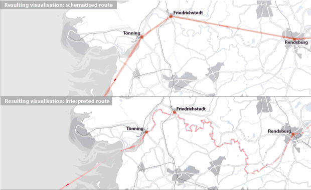
This is the first time that I see the term schematisation used outside of my research group to describe the process of map abstraction. Although it used here to describe a visualisation technique (in cartographic terms, that is generalisation) it is similar to the drawing people produce when externalsing the cognitive schematisation that happens in their minds when listening to route descriptions or reading tactile maps with their fingers.
No comments:
Post a Comment